Wildfire risk in Hays County: Wimberley and the access problem
Our Satelife report for River Road in Wimberley returns
28.78 / 100 — Moderate, with a 30.6 / 100 hazard
layer and a 25 / 100 road-access layer. The wider
community analysis scores lower at 21.54 / 100, but it still places 231
structures behind 54 exits with only one mapped fire station in range.
A recreation valley with roads that are better for weekends than evacuations
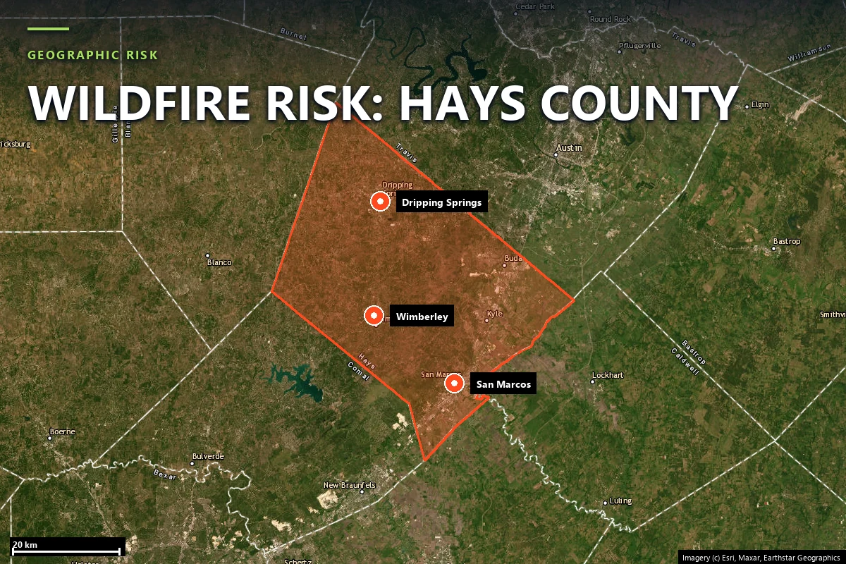
Hays County spans two different Texas growth stories at once: the rapid Interstate 35 belt of San
Marcos, Kyle and Buda, and the far more wildfire-sensitive Hill Country side around Wimberley,
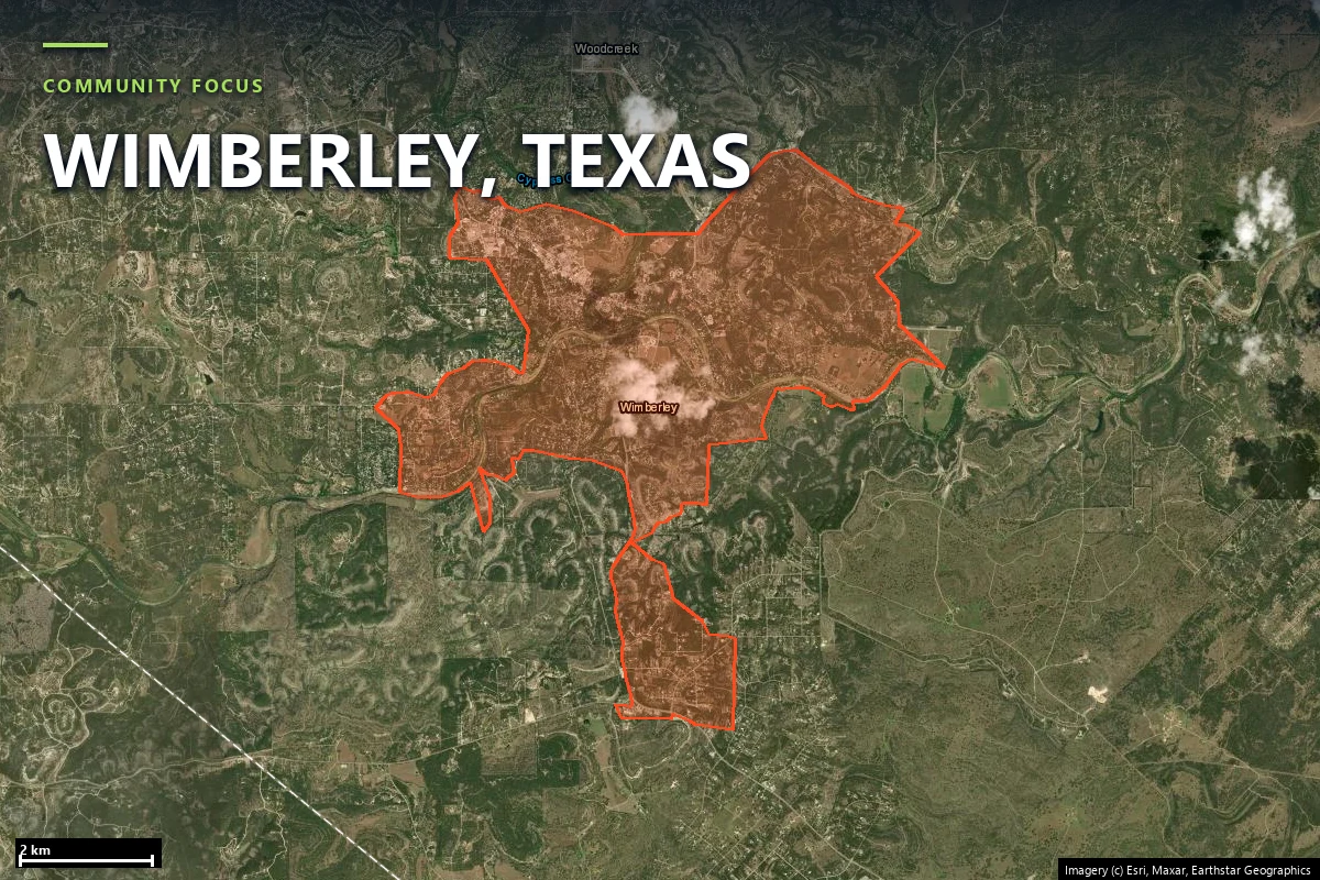
Driftwood and Dripping Springs. Wimberley sits in the Blanco River and Cypress Creek corridor, in a
landscape of oak-juniper cover, vacation rentals, river lots and curved roads that follow water and
relief rather than a grid.
That terrain has already produced recent fire stress. Local reporting put the Oak Grove
Fire near Wimberley at about 400 acres in 2023. By Texas standards that is
not a record event; by Wimberley standards it is large enough to remind residents that a scenic
canyon community does not need six figures of acreage to have a serious evacuation day.
Wimberley from Old Baldy — the built valley floor with wooded slopes and ravines around it.
Source:
Wikimedia Commons
(CC BY 4.0).
Sources: local reporting on the 2023 Oak Grove Fire near Wimberley; parcel and community figures
from Satelife reports generated 25 July 2026.
Terrain & fuel
The fuel is not extreme. The road geometry is the reason this page exists
The River Road property is not a Panhandle grass parcel and not a regrown burn-scar subdivision.
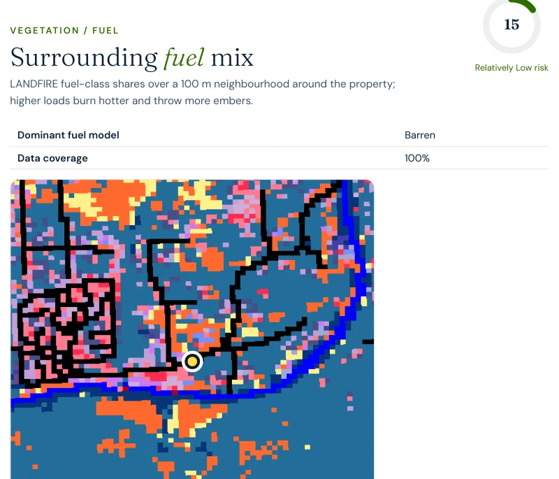
Vegetation/fuel reads only 15.2 / 100, the lowest of the new Texas counties in this
batch. The fire-spread simulation and fire-history layers both read 5 / 100.
What pulls the property into the Moderate band is the combination of terrain, climate, hazard and
access: 74 vision, 59.2 climate, 40 terrain,
30.6 hazard and 25 road access.
That split matters. Hays County’s wildfire profile is not “heavy fuel everywhere.” It is “moderate
fuel in a place where approach, turnaround and width matter more than outsiders assume.” That is why
the mitigation plan leads with annual defensible-space review and access clearance rather than with
a more aggressive structure-hardening sequence.
Evacuation
One mapped station, 54 exits, and a lot of houses behind them
The neighborhood run clarifies how Wimberley’s wildfire problem scales. The community score is low,
but the road network is not especially loose once you convert it to structures per exit.
231structures in the analyzed community footprint
54independent road exits across 2,860.9 hectares
4.28structures per exit route
1OSM-mapped fire station serving the analyzed area
3.6 minfastest modelled engine time
4.4–8.3 minmodelled hotspot-zone drive-times
The run did not return a non-null single-point-failure width, so this page does not pretend to have
one. What it does have is enough to be specific: a modest exit count relative to built structures,
one mapped station, and a parcel whose access layer is materially worse than the wider footprint.
That combination is the Hill Country version of wildfire exposure — not catastrophic flame modelling,
but a lot of dependency on roads that were not laid out for mass movement.
Report excerpt — Road access: suppression reach & egress, Satelife Wildfire
Risk Report, River Road, Wimberley TX 78676 (July 2026). Drive-times are modelled on the public
road graph and OSM-mapped stations; decision support, not an evacuation plan.
Hazard framing
Moderate because of route and setting, not because the flame model is screaming
The federal flame-length model for this parcel is restrained: 0.2% probability of
flames over four feet and 0.1% probability over eight feet. Those are real, low
numbers, and they matter. What moves the River Road parcel into Moderate territory anyway is the
combination of a 30.6 hazard layer and a 25 road-access layer, with a 74 imagery read on top.
28.78property composite score — Moderate tier
21.54community score — Low tier
30.6hazard layer, the property’s largest weighted pressure point
0.2%probability of flames over 4 ft; 0.1% over 8 ft
This is exactly the kind of Texas result that would be misread if you looked only at the headline.
Wimberley does not score like Fritch, and it does not need to in order to present a real evacuation
and access problem. Moderate here means “watch the roads and the parcel clearance,” not “expect a
crown-fire analogue.”
Hays County is a reminder that Texas wildfire risk often arrives through geometry first and flame
length second.
Case study
One address on River Road, scored today
We ran a full Satelife wildfire-risk report for a property on River Road, Wimberley TX
78676. The composite returns 28.78 / 100 — Moderate tier, at
0.82 confidence.
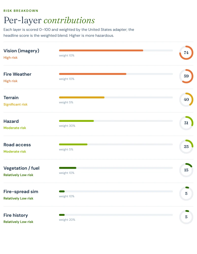
Report excerpt — Per-layer contributions, Satelife Wildfire Risk Report, River
Road, Wimberley TX 78676 (25 July 2026). Composite 28.78/100, Moderate tier, scored under the
United States (usa_generic) adapter.
What drives the score:
Vision: 74 / 100. The imagery read sees the structure in a wooded Hill Country setting, not in an open field.
Hazard: 30.6 / 100. High enough to matter, and carrying the largest weight in the Texas composite.
Road access: 25 / 100. The route to the parcel is a meaningful contributor rather than a footnote.
Climate: 59.2 / 100 and terrain 40 / 100. These two keep the parcel from looking like a flat suburban edge.
Vegetation: 15.2 / 100. Important because it explains why the property is Moderate rather than materially higher.
The River Road parcel does not score Moderate because Hays County is full of explosive fuel. It
scores Moderate because a fairly ordinary Hill Country lot can still be hard to access at the wrong
moment.
The mitigation plan follows directly from that reading: audit defensible space annually
before fire season and verify access-route width and gate clearance.
Insurance & real estate
Wimberley buyers have to commission the answer, not look it up
Hays County is a classic Texas diligence market. Wimberley and Dripping Springs buyers are often
purchasing views, trees and topography — exactly the traits that complicate wildfire access — while
the state gives them no official hazard zone map to consult. Texas seller disclosure law does not
fill the gap because it contains no wildfire designation item to disclose.
There is also no statutory mitigation-discount schedule for insurers. Any premium benefit attached
to defensible space, gate width, turnarounds or ember resistance is a carrier judgment, not a right.
If admitted coverage fails, the backstop is the Texas FAIR Plan Association, which
requires denial by at least two writing carriers before eligibility begins.
That is why a Wimberley parcel report is commercial due diligence. It documents the road geometry,
access constraints and structure setting that a buyer or underwriter cannot infer from county-level
statistics or from a listing brochure.
Sources: Texas Department of Insurance · Texas FAIR Plan Association · Texas Property Code §5.008.
Risk reduction
What Hays County homeowners can actually do
In Hays County the standard defensible-space framework still matters, but the highest-value work is
unusually route-specific: driveway clearance, gate width, turnarounds, address visibility and
seasonal trimming before cured grasses and brush line the approach. The report’s access emphasis is
not generic boilerplate. It is the quantitative finding of the parcel.
The cleanest sibling comparison is
Comal County. Wimberley’s
property score is 28.78 / 100 Moderate, with 4.28 structures per exit
and one mapped station. Bulverde’s property score is 20.62 / 100 Low, with
1.04 structures per exit and four stations in range. Same central-Hill-Country fuel
family; very different road redundancy.
Coverage
ZIP codes we cover in Hays County
Satelife runs address-level wildfire reports across every ZIP code in Hays County.
The ZIPs below are the Hill Country and Wildland-Urban Interface
communities we are asked about most. One caveat that is the whole point of what we
do: the risk score is computed for your parcel, not the ZIP, so two
homes on the same street can land in different tiers. Find your area, then
run your address.
ZIP code
Community
Why it is on the map
78676
Wimberley
River Road case study in the Blanco River and Cypress Creek canyon corridor
78666
San Marcos
County seat and east-side growth corridor
78620
Dripping Springs
Northwest Hill Country interface and ranch subdivision growth
78640
Kyle
IH-35 growth belt between Austin and San Marcos
78610
Buda
Northern county growth front with expanding WUI exposure
78619
Driftwood
Rural oak-juniper landscape west of Buda
ZIP areas per USPS. Texas publishes no statewide fire hazard severity zone map; Wildland-Urban Interface framing per Texas A&M Forest Service.
Frequently asked questions about Hays County wildfire risk
Is Wimberley in a serious wildfire area?
Yes, but for specific reasons rather than for a headline statewide zone. A Satelife report for River Road in Wimberley returns 28.78 / 100 in the Moderate tier, with a 30.6 / 100 hazard layer and a 25 / 100 road-access layer. The neighborhood analysis is lower at 21.54 / 100, but it still serves 231 structures through only 54 exits with one mapped station in range.
Did Hays County have a recent wildfire near Wimberley?
Yes. Local reporting described the Oak Grove Fire near Wimberley in 2023 at roughly 400 acres. That is not a mega-fire in Texas terms, but it is exactly the kind of Hill Country incident that shows how quickly cured brush and canyon roads can turn a moderate parcel score into an operational problem.
Why is the property score Moderate if the community score is Low?
Because the parcel itself carries a worse access and hazard picture than the wider footprint. At the River Road property, road access reads 25 / 100 and hazard 30.6 / 100, while the wider community has more redundancy overall even though it still has only one mapped station and 4.28 structures per exit. In Hays County the property can be the tighter constraint than the town-level average.
How many exits does the Wimberley case study have?
The community analysis finds 54 independent exits for 231 structures across 2,860.9 hectares, or 4.28 structures per exit. The model did not return a non-null single-point failure measurement for this run, so the main egress takeaway is redundancy ratio and drive-time, not one exact bottleneck width.
What mitigation did the River Road report recommend?
Audit defensible space annually before fire season and verify access-route width and gate clearance. That is a more access-heavy recommendation set than Kendall or Comal County, and it matches the 25 / 100 road-access layer in the property report.
Scores and evacuation figures on this page are drawn from Satelife wildfire-risk reports generated on
25 July 2026 under the United States (usa_generic) adapter: a property report for River
Road, Wimberley TX 78676, and a community analysis for the Wimberley-area case study. Texas publishes
no statewide fire-hazard-severity map, so the hazard layer is backfilled from the USFS Wildfire Risk
to Communities model. The Oak Grove Fire reference comes from local reporting and is included only as
local context, not as a scored report input. Drive-times are modelled on OSM-mapped stations and the
current road graph. Satelife reports are informational decision support — not a substitute for official
evacuation orders, state or federal hazard determinations, or an insurer’s underwriting judgment.
What does your Hays County parcel look like, layer by layer?
If you own or are buying in Hays County — Wimberley, Dripping Springs, Driftwood, San Marcos, Kyle or Buda — get the address-level answer: PDF, per-layer score, and a prioritized mitigation plan.