Washington's fires arrive on the wind and end in towns — the Carlton Complex took more than 300 homes in 2014, Malden was levelled in 2020, Spokane County lost over 600 structures on one afternoon in 2023, and the August 2026 Spokane-area fires put 67,000 people under evacuation. The state publishes no fire hazard severity zone map to check your address against. This page explains how wildfire risk is actually scored here, and what the record already says about your town.
Highlighted counties have a published, data-backed page built on real Satelife reports for an address and a community inside them. Select one to open it. Satelife runs address-level reports statewide — the highlight marks where we have published the research, not where we can score.
Select a highlighted county to open its report page.
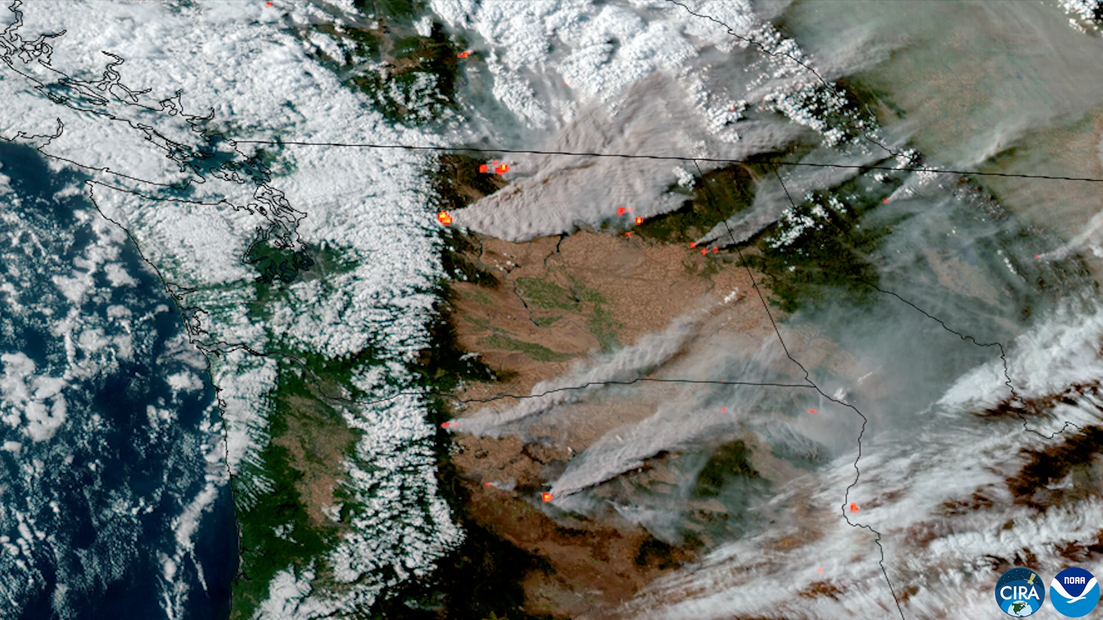
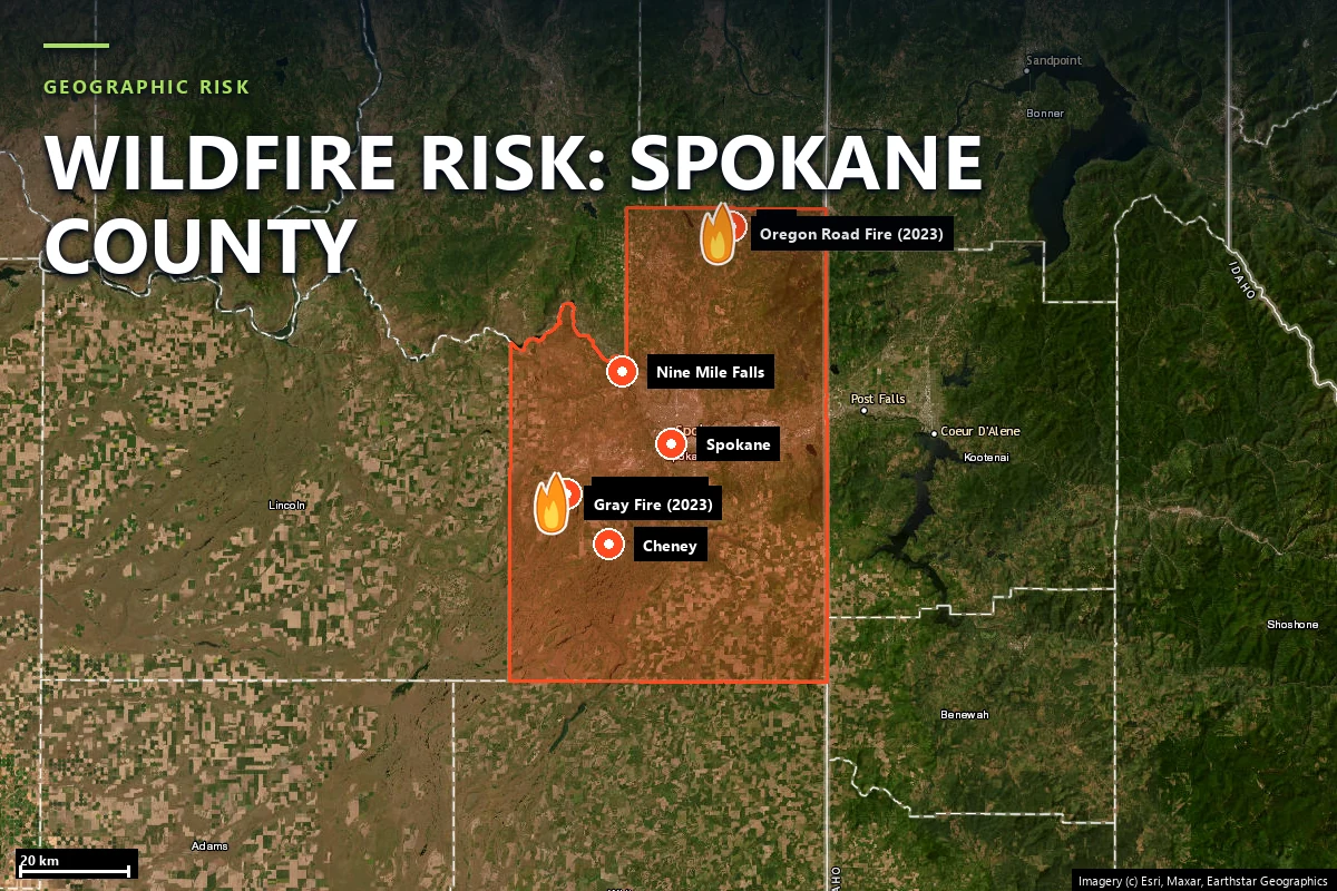
Washington's fire record is written in towns, not just acreage. The 2014 Carlton Complex burned 256,108 acres of the Methow Valley — the largest wildfire in the state's modern record — and destroyed more than 300 homes. The 2015 season burned over a million acres statewide and killed three firefighters near Twisp. On Labor Day 2020 the Babb Road Fire destroyed some 80% of the town of Malden. In August 2023 the Gray and Oregon Road fires burned into Medical Lake and Elk on the same afternoon, destroying over 600 structures. And in August 2026 the Old Trails, Autumn Lane and Fairview fires burned into Spokane-area neighborhoods, damaged or destroyed over 900 structures by early-August counts and put 67,000 people under evacuation.
The state's wildland fire agency is the Washington Department of Natural Resources, which protects 13 million acres and runs the Wildfire Ready Neighbors home-assessment program alongside its 20-year forest health treatment plan for the dry eastside forests.
The through-line in every one of those disasters is wind: sustained east or downslope winds pushing fire through cured fuel into places people live. Washington fires are measured in hours.
Sources: Washington DNR annual wildfire season reports · NIFC / WFIGS incident records · HistoryLink · contemporaneous reporting on the 2014–2026 fires.
California publishes the CAL FIRE Fire Hazard Severity Zone map; there is no Washington equivalent to look your address up in — yet. Senate Bill 6120 directed the Department of Natural Resources to build statewide wildfire hazard and risk mapping, and that work is in progress, but it is not an address-level designation today.
Satelife's reports say so explicitly on their hazard page: outside California the hazard layer is backfilled from the U.S. Forest Service Wildfire Risk to Communities model. That layer carries the heaviest weight in the composite — 30% — so in Washington the most influential number in a headline score is a modelled fire-likelihood estimate rather than a regulatory designation. At our Medical Lake case-study parcel it reads 25 / 100, sampling developed ground — while the fire-history layer at the same address reads 90 / 100, because the town has burned repeatedly.
The practical consequence: a Washington composite is less meaningful on its own than a Californian one, and the per-layer breakdown matters more. On our first Washington county page, the finding is not the headline number — it is the spread between a Moderate hazard model and a Very High fire history.
Every figure below comes from real Satelife reports run on 12 August 2026 under the United States adapter — a property on South Salnave Road in Medical Lake, and the Medical Lake city boundary at community scale — and is documented on the Spokane County page.
East of the Cascades. Ponderosa pine parkland, shrub-steppe and cured grass from the Okanogan down through the Columbia Basin to Spokane's channeled scablands. This is where Washington burns every year: the Carlton Complex, the 2015 million-acre season, Malden, the 2023 Spokane County fires and the 2026 Spokane-area fires are all eastside, wind-driven events in these fuels.
West of the Cascades. Temperate rainforest that burns rarely — and catastrophically when it does, on hot east-wind events like the 1902 Yacolt Burn, still the benchmark for what a westside fire season can be. Decades can pass between serious westside fires, which is precisely why the exposure is under-priced there.
The Wildland-Urban Interface ties the two together: Washington consistently ranks among the states with the most homes in the WUI, from Methow Valley cabins to Spokane's ponderosa suburbs to the Puget Sound fringe.
Wildfire-related non-renewals in Washington more than doubled between 2021 and 2025 — from 11,763 to 24,106 homeowners — and enrolment in the Washington FAIR Plan, the insurer of last resort, has grown more than 200% in five years. Carriers increasingly underwrite from third-party wildfire risk scores that can flag entire ZIP codes, so owners can lose coverage on modelled risk alone.
After the August 2026 Spokane-area fires, the insurance commissioner issued an emergency order — in effect 3 August through 30 September 2026 — restricting cancellations and non-renewals in ZIP codes with fire losses or evacuation orders.
The structural response is Senate Bill 6079, passed by the state Senate in February 2026: the Strengthen Washington Homes program would fund retrofits to the IBHS Wildfire Prepared Home standard and protect certified homes from wildfire-related non-renewal. Documented, parcel-level condition — what a home looks like from the air and the street, dated — is becoming the currency of Washington underwriting.
Sources: Washington Office of the Insurance Commissioner · Washington FAIR Plan · Stateline reporting, August 2026 · SB 6079 (Washington State Legislature).
Washington's Form 17 — the Residential Real Property Disclosure Statement under RCW 64.06 — asks sellers about a long list of conditions, but it contains no wildfire hazard designation, because the state does not yet publish one to disclose. A buyer doing wildfire diligence on a Methow cabin or a Spokane County ponderosa lot starts from nothing the state hands them.
That gap matters most exactly where the 2023 and 2026 fires burned: the towns around Spokane, where buyers now ask the wildfire question on every WUI transaction and the public record answers with history, not designations. Until the SB 6120 mapping ships, parcel-level evidence is commissioned rather than looked up — which is the role an address-level report fills.
Washington has no fire zones to be in — the state publishes no statewide fire hazard severity zone map. Senate Bill 6120 directed the Department of Natural Resources to develop wildfire hazard and risk mapping, and that work is underway, but there is no official address-level designation today. Satelife’s hazard layer is backfilled from the U.S. Forest Service Wildfire Risk to Communities model, and the rest of the report — fire history, fuels, evacuation geometry, an AI read of your parcel imagery — does the work a zone map cannot.
The 2014 Carlton Complex, at 256,108 acres in the Methow Valley, is the largest in the state’s modern record; it destroyed more than 300 homes. The 1902 Yacolt Burn is the historical westside benchmark. By structure destruction, the 2020 Babb Road Fire that levelled most of Malden, the 2023 Gray and Oregon Road fires in Spokane County (over 600 structures on one afternoon) and the August 2026 Spokane-area fires (over 900 structures damaged or destroyed by early-August counts) are the events insurers now price from.
East of the Cascades, roughly July through early October, peaking in August — the Gray, Oregon Road, Old Trails, Autumn Lane and Fairview fires were all August events, and Firestorm ’91 was mid-October on the season’s last wind. West of the Cascades the season is shorter and quieter, but hot east-wind events in late summer can burn westside forest at a scale seen only a few times a century.
Yes. The Washington FAIR Plan is the state’s property insurer of last resort and covers fire among its basic perils. It is designed for owners the admitted market has declined, its coverage is narrower and typically more expensive than a standard homeowners policy, and its enrolment has grown more than 200% in five years — largely on wildfire non-renewals in eastern Washington.
Yes — Satelife runs address-level reports statewide under its United States adapter, scoring hazard from the USFS Wildfire Risk to Communities model, fire history from NIFC/WFIGS perimeters, fuels from LANDFIRE, climate from a 30-year ERA5 reanalysis, plus terrain, fire-spread simulation, road access and an AI vision read of the parcel. The Spokane County page documents a complete worked example for Medical Lake.
PDF + property-level risk score + mitigation action plan you can hand to your insurance agent. Address-level, not ZIP-level — which in a state still drawing its hazard map is the only level there is.
Start with your address →