loading...
loading...
AI-DRIVEN WILDFIRE MITIGATION

Don't Assess, Act Confidently

Satelife uses AI & satellite imagery to provide each year expert recommendations to lower the wildfire damage risk for your site/ home / ground / property / etc.

Wildfire risk assessment tool shows risk for California neighbourhood
Satelife wildfire risk assessment tool analyses California neighbourhood
Satelife wildfire mitigation tool gives personalised recommendations to lower wildfire risk

We empower insurance companies, real estate agents, and homeowners to proactively reduce risks and protect properties from wildfires.

Powered by leading Technologies for Optimal Performance.

Why Choose Satelife?

Reduce Risk, Lower Premiums

Satelife reduces wildfire damage risk with AI and satellite data, enabling insurers to lower premiums. Our proactive approach protects properties and decreases the likelihood of claims.

Wildfire risk satellite map
Satelife wildfire mitigation tool shows wildfire damage risk factors on map

Interactive Risk Maps

Our interactive maps detail the specific wildfire risk factors for any area, using clear, easy-to-understand visualizations. These tools help insurance agents and homeowners make informed decisions about property safety and land use.

Expert Mitigation Advice

Twice annually, Satelife provides expert advice on reducing wildfire risks, based on the latest data and prevention practices. This guidance helps insurers advise policyholders on effective protection measures, promoting safer communities and potential premium reductions.

Insurance low-risk clients
Wildfire risk assessment

Innovating Wildfire Risk Management in USA

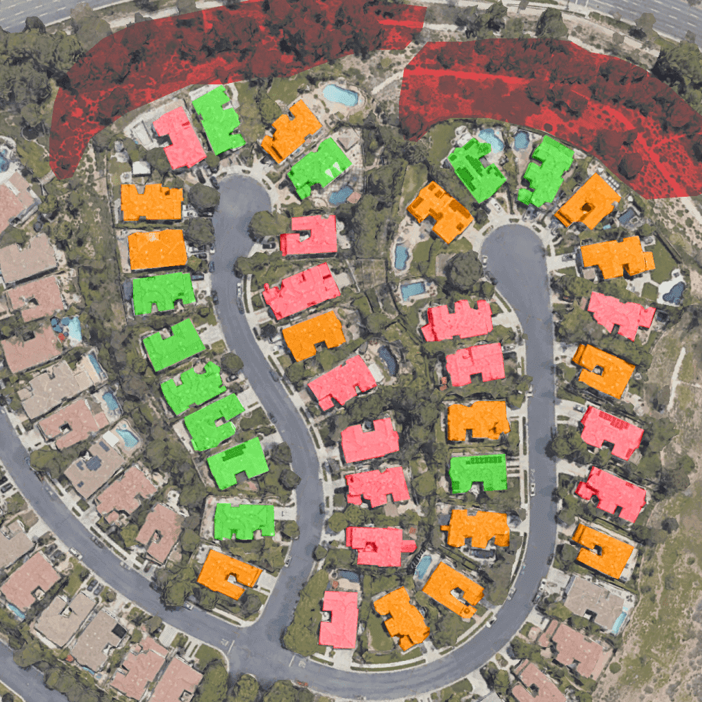
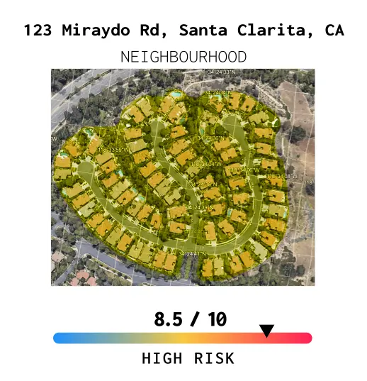
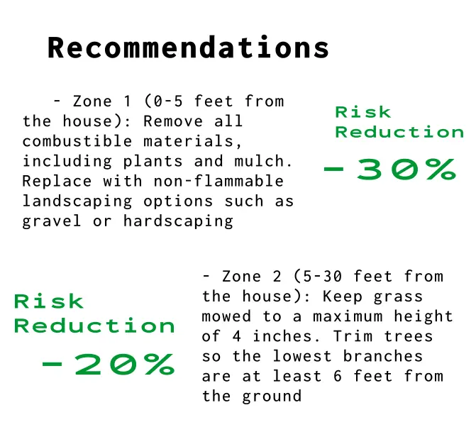
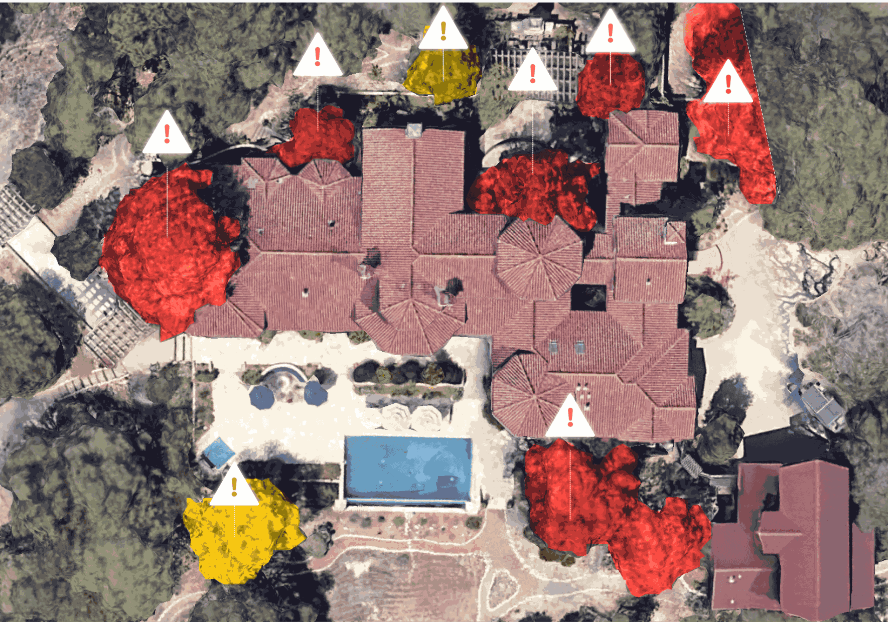
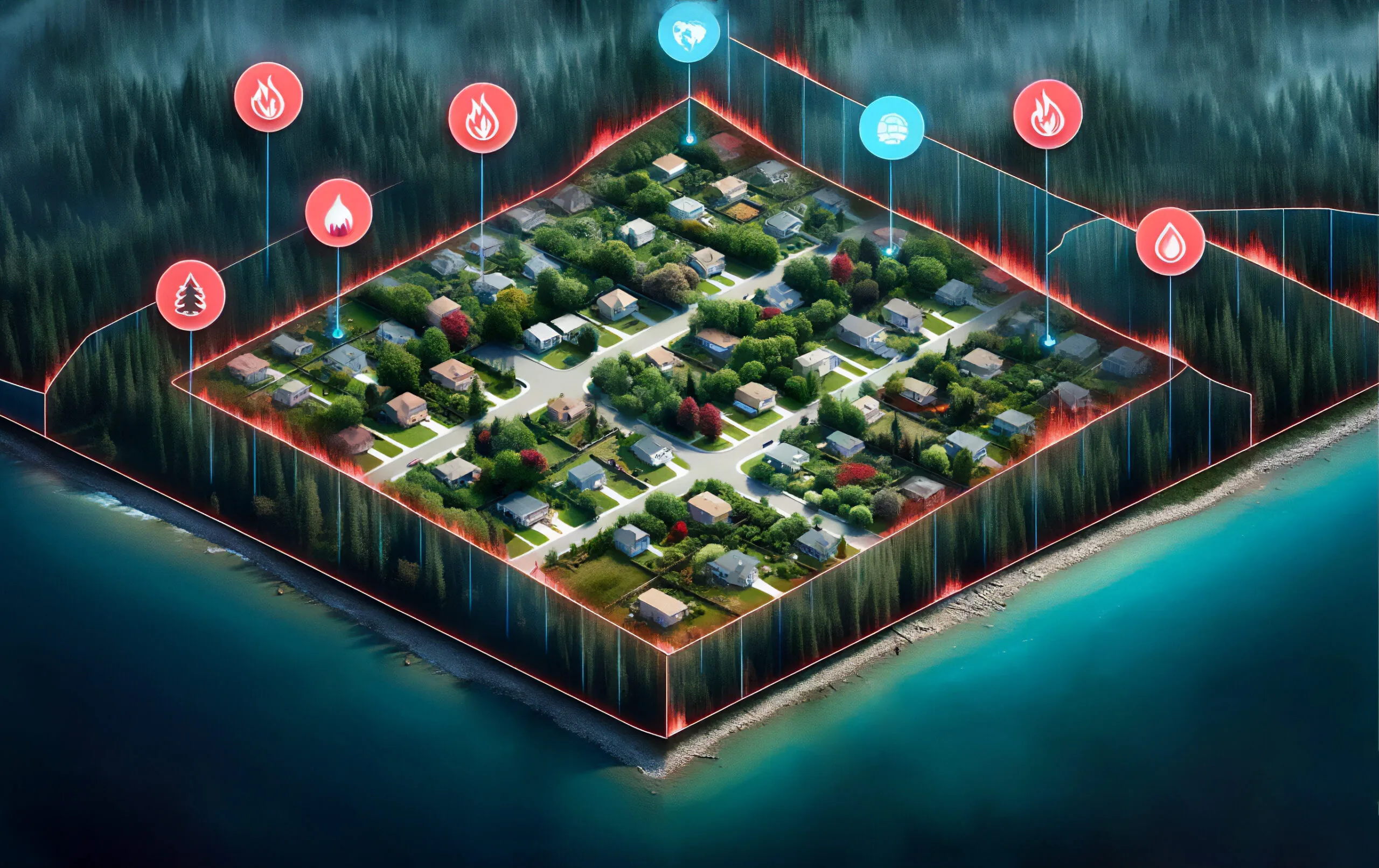
As wildfire risk increases, many leading insurers have left California, and those that remain have raised insurance premiums. Insurers could offer discounts for risk mitigation but lack precise tools to identify the necessary actions. Satelife changes this with advanced satellite imagery and AI analytics, providing clear insights and actionable guidance for homeowners to effectively reduce risks. This technology enables insurers to offer more accurate assessments and affordable premiums, ensuring safety and peace of mind for all USA residents. Embrace confidence with Satelife’s innovative approach.

How Satelife works?

01
Satellite Imagery Collection

We utilize satellites to continuously gather high-resolution images of terrains and potential wildfire zones, ensuring our data is always current.

02
AI-Powered Analysis

Our transparent AI algorithms analyze the imagery, integrating historical data and terrain maps to pinpoint areas at risk.

03
Personal Recommendations

Satelife generates comprehensive wildfire risk mitigation strategy, equipping insurers with the information needed to direct property owners toward effective preventive measures.